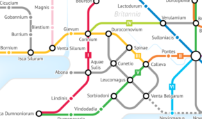
Fourth century Wessex was one of the most prosperous parts of the Roman empire, noted for its agricultural wealth. The area between the capital of the Atrebates at Silchester and the legionary fortresses at Exeter and Gloucester became known as the “villa belt”, due to the abundance of settlers building detached luxury homes at the expense of long-established settlements. Plus ça change.
These fortresses and civitas capitals needed straight, paved roads to connect them, to allow the legions to march by the most direct route possible. Silchester formed the start/destination point for three major roads: Ermin Way (not to be confused with the similarly-named Ermine Street), to Carmarthen via Cirencester and Gloucester; the Portway, to Exeter; and the appropriately-named Devil’s Highway, to That Londinium. Meanwhile, the Fosse Way linked Exeter to Lincoln, again via Cirencester.
Sometimes, the Romans upgraded existing roads rather than building new ones. For example, Icknield Way (again, not to be confused with Icknield Street) was built over a prehistoric trackway that crossed the Thames at Dorchester, thus making it a strategically important settlement and the later capital of the Gewissae.
While most “now lie waste and deserted”, a few Roman roads survive in Wessex today. The Fosse Way forms part of the A37 in Somerset, while it is still possible to drive from Newbury to Gloucester along the route of the Ermin Way.

